


-
Highlights
Visit the sources of four of the Alp’s biggest rivers in one trip!
Breathtaking views, high alpine passes and rugged trails circling the heart of the Alps: The Gotthard massif
Easy access and less crowds than other popular hikes!
Join the fun!
>>Inquire about dates for 2025<<
The tour of the four headwaters is a wild adventure and a once in a lifetime experience. It visits four of Switzerland’s most important water springs that feed large rivers flowing into Germany, the Netherlands, France and Italy and have provided a source of life for millions of people since the very beginning of recorded history!
And what’s more, you get to experience firsthand the economical and cultural importance of Alpine passes and old trade routes. You will be immersed in history all along the trail on this hiking tour.
But, it is not for everybody. In addition to a lot of elevation gain over the high mountain passes, the Alps are notorious for quick weather changes. This tour is feasible from mid-June to mid-September. Otherwise the higher sections of hiking trail are likely covered in snow and mountain refuges may be closed.
Trip Itinerary
Day 1:
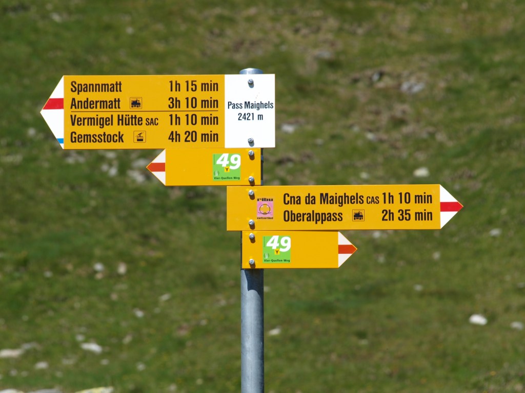
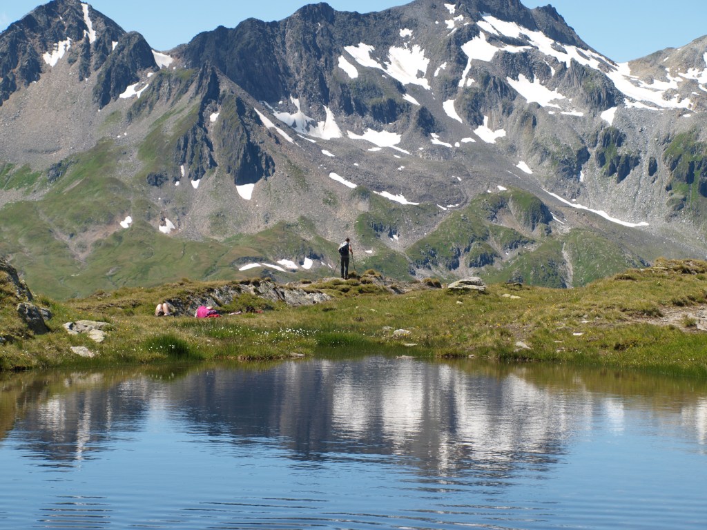
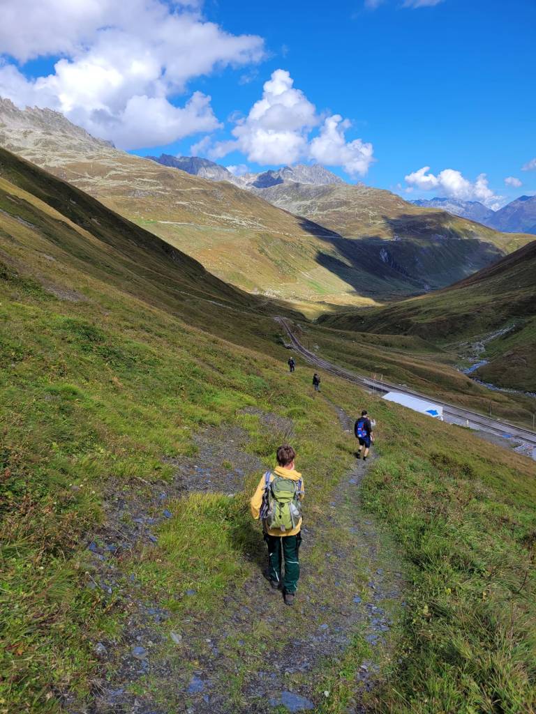
Your adventure starts meeting the guide at the Oberalppass, a 15 Minute train ride from Andermatt. We don’t waste any time and start a gentle climb to arrive on the summit of Pazolastock. What a view we have from here! We continue along the Tuma ridge an a long downhill takes us to the source of the Rhine and the dreamy Lake Tuma.
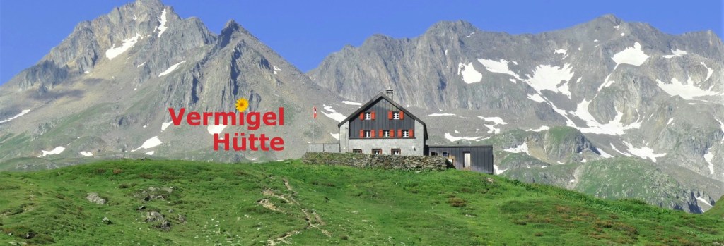
After a break we descend into the Maighels valley and follow it past ponds and cow herds to the very end, where a steep descend brings us to the day’s goal, the Vermigel mountain hut.
A cozy place, far away from the stress and noise of everyday life, and after dinner you can relax a bit or spend time with friends until you are ready to call it a day.
Distance covered: 16 kilometers (about 10 miles)
Elevation gain: 1000 meters (about 3,000 feet)
Approximate hiking time: 6 Hours
Accommodation: Vermigelhütte (mountain refuge)Day 2:
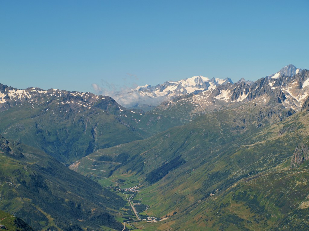
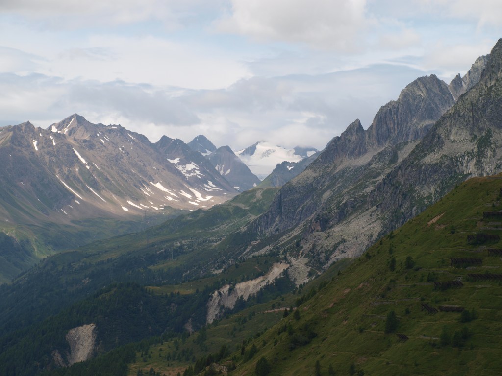
On the second day we start after breakfast to a short climb up to Sellapass and to the top of mount Giübin. This is the border of the German speaking region of Graubünden and the Italian speaking Ticino. From here we also gain a seemingly unlimited view of the Lepontine Alps and the Leventina valley.
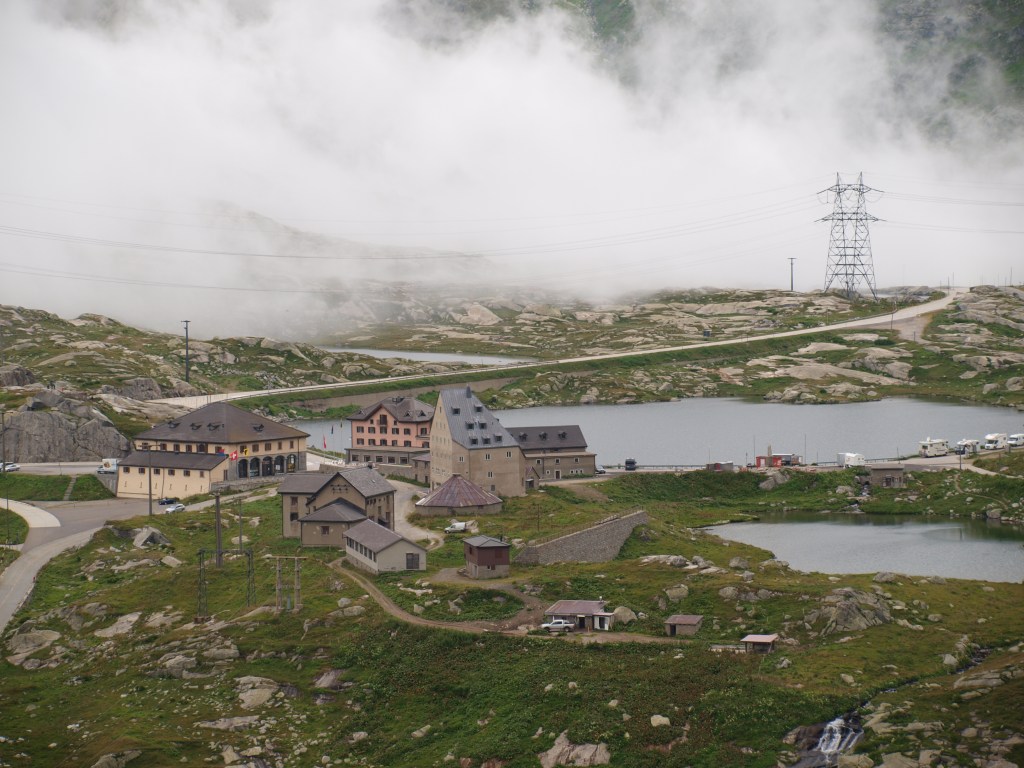
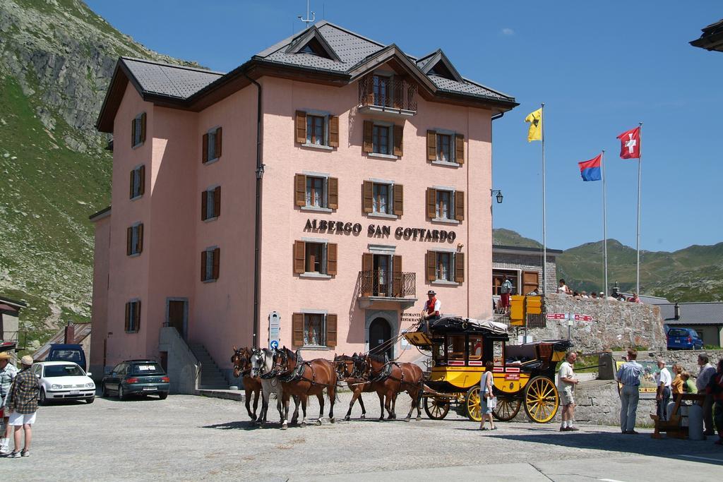
Old barracks near the mountain top are evidence of past times, when central Europe was plagued by mistrust and wars. Nowadays they are used by shepherds and farmers for shelter or storage. We descend towards Sella dam, one of many artificial lakes used for hydroelectric power generation. It is here, that the descent eases a bit before we finally reach the famed Gotthard pass. We arrive the hotel on top of the pass and get to enjoy the area after all the day tourist depart and the traffic dies.
Distance covered: 12 kilometers (about 7.5 miles)
Elevation gain: 800 meters (about 2,500 feet)
Approximate hiking time: 5 hours
Accommodation: Gotthard Hospiz (hotel)Day 3:
This will be a longer day on the trail but beautiful nonetheless and even more remote than the first two days. And it starts with an easy walk across the Gotthard pass towards another great dam: the Lago del Lucendro. Along the trail a few hidden Easter eggs will be discovered and history will become reality, as we walk the century old cobble stones of this trans alpine trade route.
At the end of the Lucendro dam we will arrive finally at the source of the river Reuss. One of the biggest tributaries to the Rhine and once a great obstacle to foreign conquerors wishing to cross the Alps. The source of the Reuss also marks the beginning of a long climb over the Lucendro pass, followed by a long traverse on a hiking high above the Bedretto valley.
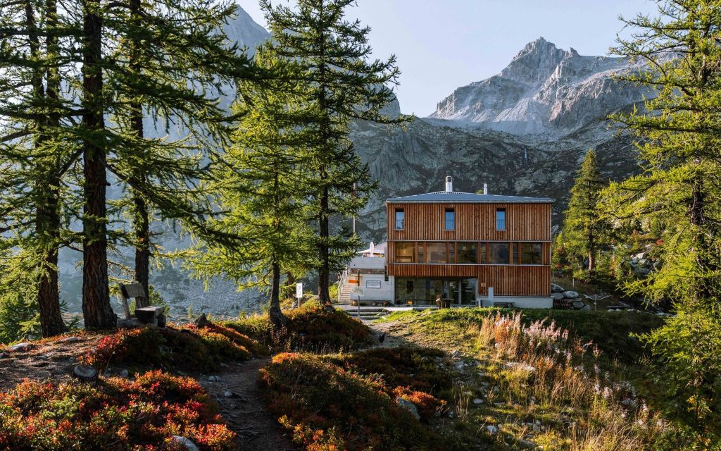
Finally, after many a short up and downhill we arrive at the day’s goal, the Piansecco mountain hut. It is a dreamy little place but rather modern, surrounded by fir trees and overlooking the Cristallina massif on the southern side of the valley.
Distance covered: 20 kilometers (about 13 miles)
Elevation gain: 800 meters (about 2,500 feet)
Approximate hiking time: 6 hours
Accommodation: Capanna Piansecco (mountain refuge)Day 4:
Today we stay at elevation, hiking along the northern slope of the Bedretto valley until we reach the road leading up to Nufenenpass. After crossing the road we arrive in a small flat area with many streams coming from the mountains surrounding it. This is the source of the Ticino, one of the major tributaries to the river Po, itself one of the most important rivers of Europe.
A steep uphill section brings us to one of the highest road passes in the Alps, the highest one entirely in Switzerland. An ideal place for a break with a view, and there’s even a café at the top of the pass!
The rest of the day’s hiking is all either flat or downhill. You get to enjoy the view even more! And you will definitely love the suspension bridge towards the end of the descent.
From here we head either for the village of Ulrichen or Obergesteln, depending on accommodation availability. In either case, you will love to rest your legs and go to sleep in a soft bed and surrounded by spectacularly tall mountains.
Distance covered: 20 kilometers (about 13 miles)
Elevation gain: 700 meters (about 2,150 feet)
Approximate hiking time: 6 hours
Accommodation: Hotel (according to availability)Day 5: Final day
When you leave the hotel after a hearty breakfast you may realize the presence of a stream close by. This is the Rhone river and you will be able to see it’s source today! It is hard to imagine that this river forms a whole delta in southern France and provides for the live of millions of people. Here, it is only a few feet wide and very shallow!
Today, we avoid the popular mountain pass road towards Bern and Lucerne. We take the bus to arrive at Furka Belvedère, which you may recognize from a 70’s spy movie. A short walk away from the roads lands us at a fantastic lookout point, high above the Rhone glacier. And this is where one of Europe’s longest rivers starts!
From there, the trail takes us over the Furkapass after a short climb and then a long way down to Realp. At the Realp train station our journey ends, after 50 miles of alpine hiking trails and a few very quiet but long days in the mountains.
Congratulations! You have circled the heart of the Alps!
Distance covered: 15 kilometers (about 8 miles)
Elevation loss: 1,000 meters (about 3,000 feet)
Approximate hiking time: 5 hours


About the Trip:
Facts:
- 4 Cantons / Regions
- 80 km (50mi)
- 3,500m (11,500ft) Climbing
- Group Size 4-6
- 4 Nights & 5 Days Trekking
- Nearest Airport: Zürich
- Meetup: Andermatt
- Difficulty Level: Challenging
Join the fun!
>>Inquire about dates for 2025<<
From $ 1,725 US per person guided or $ 1,225 US self-guided.
