


-
Highlights
Visit three different countries in one trip: France, Switzerland, and Italy
Breathtaking views, high alpine passes and rugged trails circling the highest mountain in the Alps, Mont Blanc
More comfortable accommodation than most other multi-day treks in the Alps
Join the fun! Accommodation and tours fill quickly. Reserve now for a guaranteed spot in 2026!
Inquire for 2026: 57hours.com
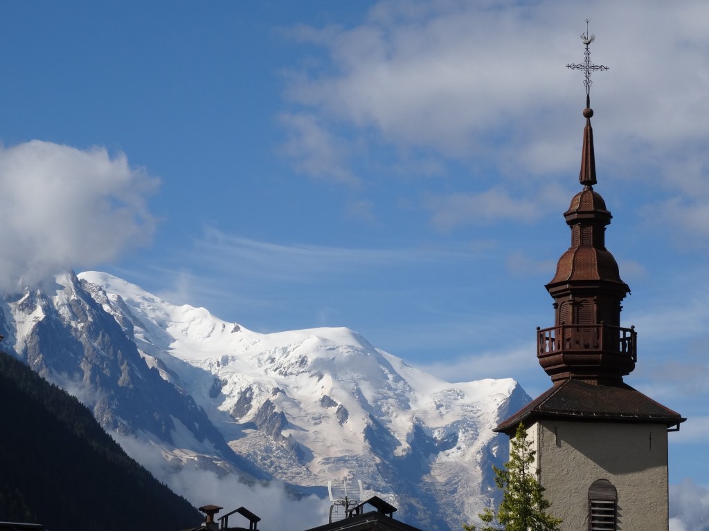
The Tour du Mont Blanc is the most beautiful multi-day trek in the Alps for a good reason: while traversing three countries you circle the highest mountain of the Alps: Mont Blanc, which culminates at 4,808 meters above sea and is commonly known as the birthplace of alpinism!
We love the Tour du Mont Blanc and so will you. However, it is not for everybody. In addition to a lot of elevation gain over the high mountain passes, some sections of hiking trail are exposed and require sure-footedness. Additionally, the Alps are notorious for quick weather changes. It is not uncommon to encounter snowfall on the trail even in August!
This tour is feasible from mid-June to early October, otherwise the higher sections of hiking trail are likely covered in snow and mountain refuges may be closed.
Don’t miss your chance, places are limited!
Trip Itinerary
Day 1: Les Houches to Tour Montroc
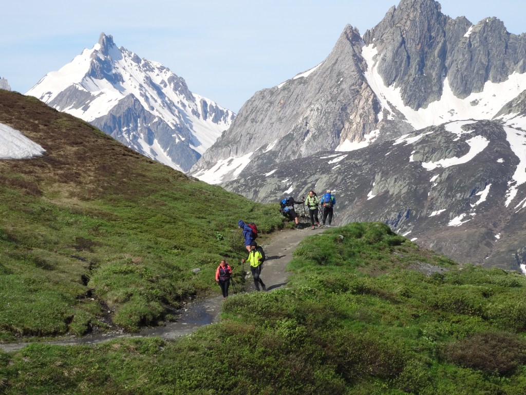
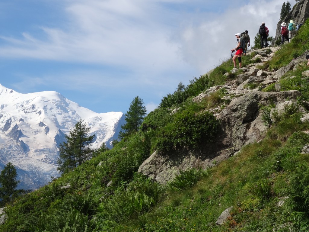
Your adventure commences at the Tourist office in Les Houches, a convenient starting point accessible by bus from Chamonix center. Right from the start the trail sets the pace: the climb to reach the Brévent cable car station is long, but a lunch break and 360 degree view awaits! The trail then takes you along the Grand Balcon through alpine meadows and serene forests, showcasing the diverse natural beauty of the region. You pass by the Aiguille Rouges nature reserve and the Chésery mountain lakes on this stage. After a long first day you reach the town of Montroc and you are properly introduced to Mont Blanc. Your rest is well deserved! Depending on the conditions and weather this stage may be shortened by avoiding a long ascent using the Planpraz cable car.
Distance covered: 27 kilometers (about 16.8 miles)
Elevation gain: 2000 meters (about 6,500 feet)
Approximate hiking time: 8 Hours
Accommodation: Gite le Moulin
Day 2: From Tour to Champex-LacOn the second day of your Tour du Mont Blanc journey, you set out for the stunning Col de Balme, a high mountain pass that marks the border between France and Switzerland. This stage offers an opportunity for some excellent photographs amidst the grandeur of the Alps. Crossing into Switzerland, you will descend to Trient and gradually climb to Col de la Forclaz, a good spot for a lunch break. Leaving the pass, you climb further still to reach the open meadows of Alp Bovine, where you are treated to stunning views of the Rhone Valley stretched out below. As you continue from Bovine, you’ll enter a serene forested area around Champex-d’en-Haut. The cool shade of the trees and the gentle rustling of leaves create a soothing and tranquil atmosphere and lets you reflect on the highlights of the day before arriving at the Col de Champex where you conclude this stage.
Distance covered: 25 kilometers (about 15.5 miles)
Elevation gain: 1700 meters (about 5,500 feet)
Approximate hiking time: 7 hours
Accommodation: Gîte Bon Abri
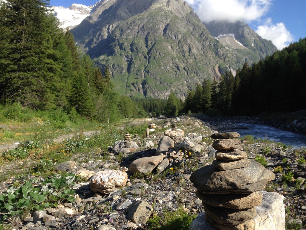
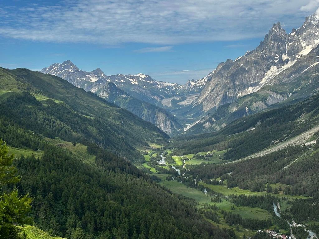
Day 3: The Swiss Val Ferret
Leaving Champex-Lac behind, you’ll descend to the valley of the Dranse river, as it meanders through the Val Ferret, creating a tranquil and soothing ambiance. After a gradual climb to warm up the legs you reach La Fouly, a dreamy hamlet at the end of the valley. From there, the trail takes you on a long but rewarding ascent over the Grand Col Ferret. This pass marks the border between Switzerland and Italy and is the highest point of the classical Tour du Mont Blanc. Here, trekkers stand in awe of the breathtaking views of the sheer rock walls of the Mont Blanc massif, which dominates the skyline. A steep descent leads to Rifugio Elena in the italian Val Ferret, where you can rest your legs on the inviting terrasse after a long day of hiking.
Distance covered: 26 kilometers (about 16.2 miles)
Elevation gain: 1600 meters (about 5,200 feet)
Approximate hiking time: 7 hours
Accommodation: Rifugio Elena mountain hut
Day 4: The Italian Val Ferret
Right at the start a steep descent leads you to the bottom of the italian Val Ferret and then you climb back up to follow the contours of the Mont de la Saxe. The trail offers only little ups and downs in this section and you can enjoy captivating views of the surrounding landscapes and the majestic peaks of the Mont Blanc range. The path then descends, leading you down into the delightful town of Courmayeur, an Italian alpine resort known for its charming streets, vibrant atmosphere, and delectable cuisine. Sure enough, you will be able to enjoy authentic Italian cuisine tonight!
Distance covered: 19 kilometers (about 11.8 miles)
Elevation gain: 500 meters (about 1,600 feet)
Approximate hiking time: 5 hours
Accommodation: Hotel Viale close to town squareDay 5: The Val Veny
It is time to say goodbye to Bella Italia. A steep ascent leads you to the Chécrouit pass. Upon reaching the Col Chécrouit, you follow the Mont Favre ridge line that offers trekkers spectacular panoramic views of the Mont Blanc massif. Then, on the way down to the Combal lake, you pass the last forested area, before the trail leads you on a long and gradual climb through the Val Veny to the Col de la Seigne. This significant high mountain pass marks the border between Italy and France and is the second highest point along the classic Tour du Mont Blanc. After the Col de la Seigne, the trail leads you down to the Refuge des Mottets, a welcoming mountain hut that concludes the day’s journey.
Distance covered: 24 kilometers (about 14.9 miles)
Elevation gain: 1800 meters (about 5,900 feet)
Approximate hiking time: 7 hours
Accommodation: Refuge des MottetsDay 6: Over the Col de la Croix de Bonhomme
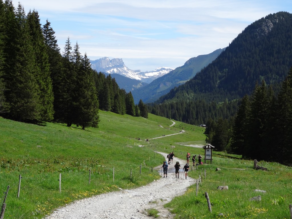
The day starts with an easy downhill path to Les Chapieux, transitioning into a unique hiking experience. Notably, this stage rejoins forested areas only towards the very end, allowing trekkers to fully immerse themselves in the open alpine landscapes. As you leave Les Chapieux, the trail takes a challenging turn, with a steep climb leading to the Col de la Croix du Bonhomme. This ascent is rewarded with panoramic views and an authentic sense of accomplishment. The trail then descends into the picturesque La Balme pasture and leads you to the Pont Romain, a relic of ancient roman roads. Following this, the picturesque Notre Dame de la Gorge chapel awaits you as a reminder that the end of the day’s hike in Les Contamines is not far.
Distance covered: 22 kilometers (about 13.6 miles)
Elevation gain: 900 meters (about 2,900 feet)
Approximate hiking time: 6 hours
Accommodation: Hotel Gelinotte close to town squareDay 7: Final day over the Col de Tricot
Your last day on trail! You start easily near the tourist office in Les Contamines. If you still have some appetite after breakfast you will be delighted to taste a mocha Eclair, the most iconic of french pastries aside from the croissant!
Then, through serene forests where the birds sing to welcome the morning sun, you finally reach the Chalets de Truc. Here, you can enjoy the amazing view of the Domes des Miages and Aiguille de Bionnassay. As the trail continues, another short but steep ascent towards the Col de Tricot brings you to the highest point of this day. There, you’ll be rewarded with breathtaking views of the surrounding peaks, the perfect spot for a short break! The descent from the Col de Tricot leads to a suspension bridge that spans the Torrent de Bionnassay, creating an exciting and memorable crossing. As you continue, the trail takes you uphill to Bellevue, where you can catch your first glimpse of Chamonix, offering a sense of achievement and anticipation. A final downhill brings you to Les Houches, where the finish arch awaits at the Tourism Office.
Congratulations on your amazing feat! You rock!
Distance covered: 18 kilometers (about 11.2 miles)
Elevation gain: 1250 meters (about 4,100 feet)
Approximate hiking time: 5 hours


About the Trip:
Facts:
- 3 Countries
- 170 km (105mi)
- 10’000m (33,000ft) Climbing
- Group Size 4-6
- 6 Nights & 7 Days Trekking
- Nearest Airport: Geneva GVA
- Meetup: Chamonix
- Difficulty Level: Very Challenging
Join the fun!
Inquire for 2026 on 57hours.com
From $ 2,450 US per person guided or $ 1,550 US self-guided.
